Yakusugiland is the most accessible of all the trails on the mountain. There are a variety of paths to follow and they are divided according to their estimated duration. As the name suggests there are many yakusugi trees to see including Buddha sugi. All the paths are mapped and explained in my book including extra information on each tree but you do get the map below when you pay the entrance fee (¥300).
Yakusugiland Leaflet (English)
The 30 and 50 minute courses are wooden and stone walkways and are popular with less able tourists who want to get a taste of the forest.
The 80 and 150 minute courses lead you over the bridge above and then the paths return to the forest floor and occasional wooden slats.
The 150 minute course meanders through the forest mostly climbing up and at the first rest hut there is a path signed to Tachu Dake.
The T1 trail is not as easy as it appears on the map of Yakusugiland.
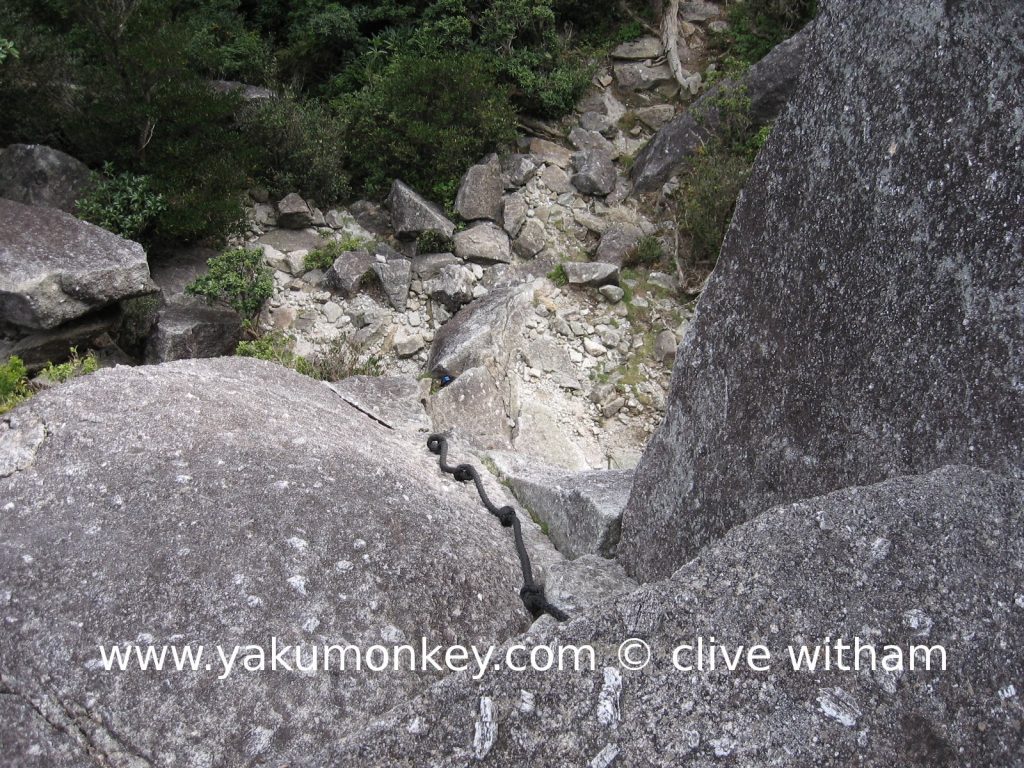
It is pretty much a hard slog upwards on a clearly marked trail and it really is tough-going towards the top. There are ladders and ropes to climb up and down so watch out for very windy days.
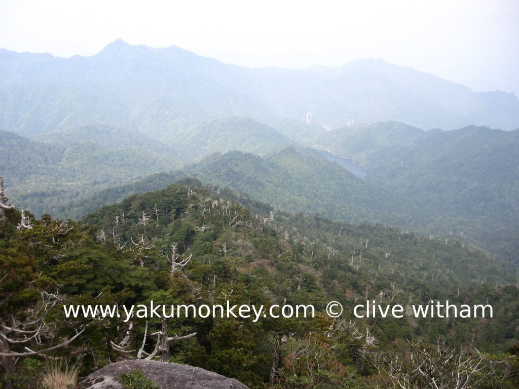
When you reach the summit, you are rewarded with a spectacular view on a clear day. There is a large flat rock to sit on and look out eastwards to Anbo and the sea in the distance.
For more information about Y3 and the T1 Trails – check out the one and only Yakumonkey Guide to Yakushima
Comments
 HI! There will be a group of us climbing here in late Oct, is it necessary for us to hire a guide to get up to Tachu Dake?
Providing you have no health conditions or any special needs, then no. Like almost all the trails in Yakushima, the trail up to Tachu-dake is usually clear enough to hike without the need for a guide. Tourists normally hire guides for the information that they give about the fauna and flora not because they need one for the trail.
 We just bought your book, which is much better than anything we found in Japanese. We were thinking about walking straight past Yodogawa Hut and spending the first night at Ishizuka Hut, then doubling back towards Miyanoura-dake the next morning. But you say that the Ishizuka trail is difficult and dangerous in places. What’s it like between the hut and Hananoego?
Hello Steve, the difficult part is below the hut so if you’re coming from above there shouldn’t be many problems. The Ishizuka hut is normally deserted so is far more preferable if you want a bit of peace and quiet – the only drawback being it’s 50 mins off the Yodogawa trail. Due to a recent helicopter accident the repairs to the Yodogawa trail have been put back so the trail should be open.
 Hey so I’m thinking about hiking this trail, looks pretty cool. I have two questions though that I couldn’t find the answer for – is it possible to hike the trail in a day(including bus sched)? / Where exactly is the entrance to the trail? I know you say the “long mountain road from Anbo” is that a road you can bus it to the trail entrance (i.e. clearly marked, etc.) Thanks for keeping this site up and all, it’s been really helpful!
Yes, it’s normal to hike this as a day trip. The entrance to the trail is actually in Yakusugiland which you can access easily by bus. Look at the bus timetables at yakumonkey.com/p/yakushima-bus-timetables and Yakusugiland is on the Kigensugi-Gochomae route.
 Hello! I bought your book and am so grateful you took the time to write it! We’ll be spending three days in Yakushima on our trip. I have two questions if you don’t mind:
1) How long does it take to get to the top of Tachu Dake if you really hustle? (we’ll be flying in around noon from Osaka and I was wanting to hike to Tachu Dake and back before the sun set at 6:30. 2) Coming in early April, will we need a heavy duty jacket if we hike to the top of Miyanoura?
The hike up to Mt.Tachu is a 5 and a half hour return trip. Yes, you’ll need warm clothing at the top of Miyanoura dake for sure.


